Why Habitat Mapping is the key to installing woody habitats
We all see the fantastic vision of a large machines dropping woody snags and rocks into the river, but how exactly do OzFishers decide where to put those grand new habitats?
Recreational anglers, researchers and land managers broadly know the types of habitats found in their local waterways, but detailed information is usually patchy and highly variable, particularly in areas less accessible to the general public.
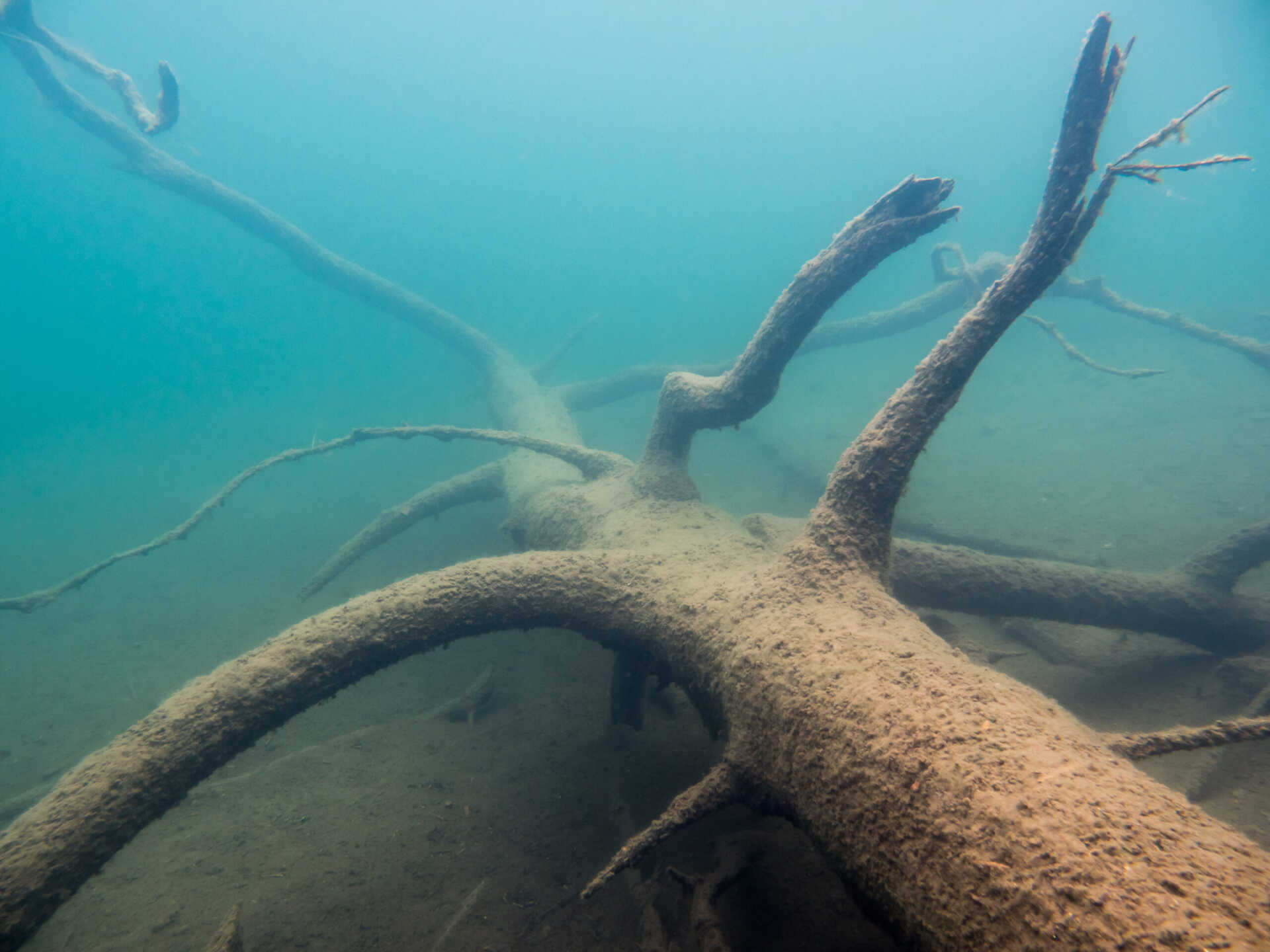
Whilst we might see the top of a snag while walking the bank, this is only a fraction of what exists under the surface.
In-stream woody habitats are highly valued because of their contribution to supporting river biodiversity and self-sustaining fish populations.
Fish such as the Murray Cod and Golden Perch will use horizontal trees and rock congregations as a place to seek refuge during the day, to breed, and to ambush their prey.
Just like we have our bedroom or living room, the fish have woody structures.
The lack of woody habitats within the Murray-Darling Basin waterways has been identified as a major contributing factor to the decline in numbers of many large bodied native fish species.
Most snags were historically intentionally taken out to increase the navigability of the river.
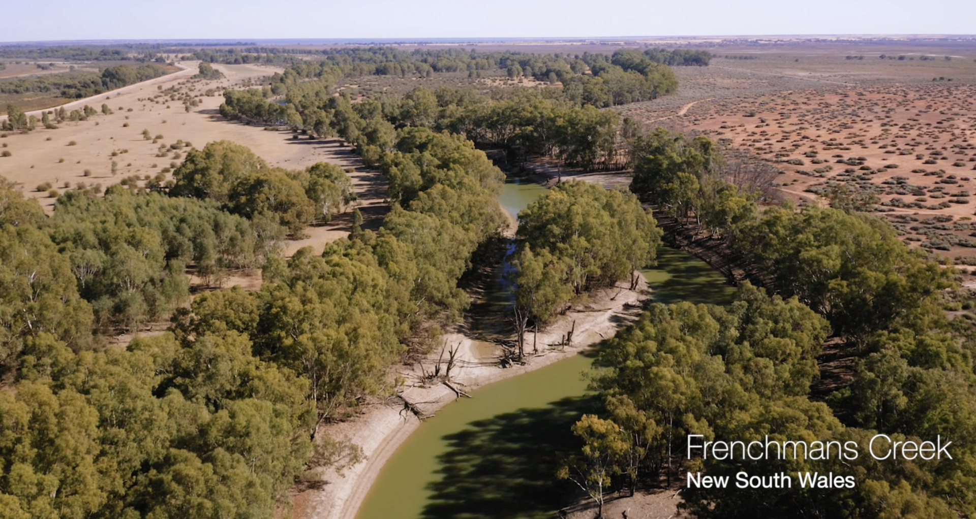
In looking to ensure that this is a problem of the past, OzFish volunteers and key stakeholders have used their collective expertise, equipment and time to map all the woody habitats that are located within the Rufus River, Frenchmen’s Creek and Carrs and Cappit Creek.
The information has allowed them to understand where the existing habitats remain, and where there are areas that are lacking sufficient snags.
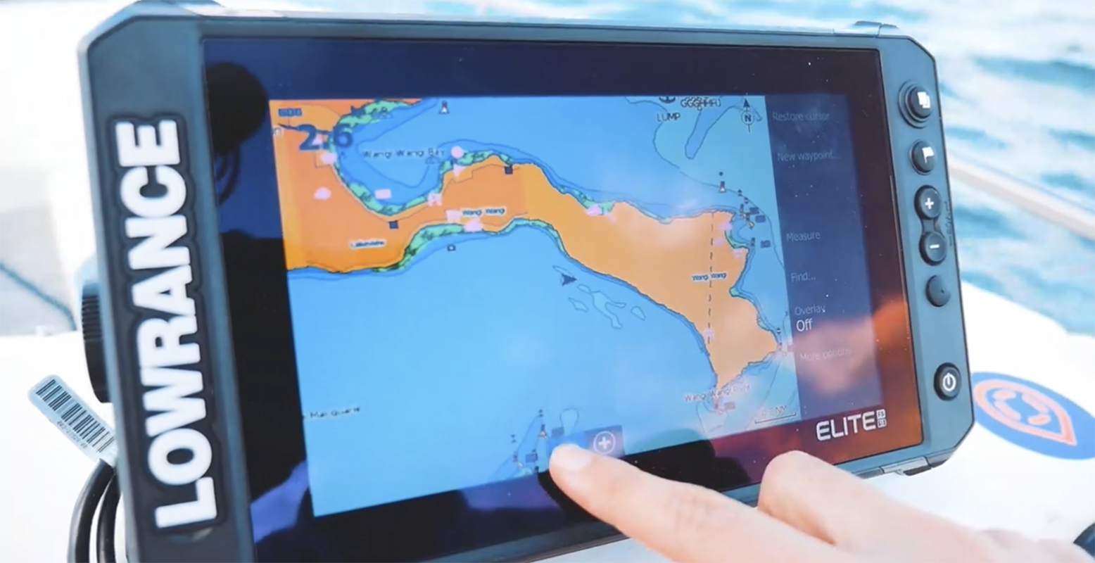
Using the latest side-imaging sonars, such as a Lowrance unit, the volunteers have put in over 200 volunteer hours to tick of this first stage.
The data collected here will greatly influence future habitat restoration projects and mean that no time or resources are wasted putting snags back in a location where are already plentiful.

Braeden Lampard, Program Manager for the Murray Darlin Basin, said that the process is tedious, but the results are worth it.
“It’s a slow process. It requires travelling at 2-3 knots along the banks of a river and having your eyes glued to the Lowrance Screen. Once we see a snag or something worth noting, we record its structure down and also add a GPS mark. We repeat this for kilometres of creek.”
If you would like to habitat map your own local waters, get in touch with OzFish on 1800 431 308 or at info@ozfish.org.au.
A little bit of mapping can go a long way for the local fish populations! Who knows, it might lead you to finding that new Spot X.
These projects has been proudly funded by the Wentworth Shire Council, Sunraysia River Repair Bus and BCF – Boating, Camping, Fishing.